Join Curify to Globalize Your Videos
By using Curify, you agree to our
Terms of Service and Privacy Policy
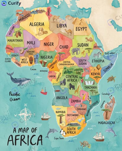
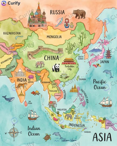
Watercolor Continent / World Map
Whimsical children's-book-style watercolor map of a continent — country outlines, landmarks, native animals, cultural symbols, compass rose, ocean illustrations. Friendly for classrooms and nurseries.
Reproduce this template
Use your inputs — the prompt preview updates instantly.
(Watercolor Continent Map Creator) Create a whimsical illustrated map of {continent_name}. Layout: The continent's outline filled with soft watercolor washes for each country, labeled with their names. Add iconic landmarks, native animals, and cultural symbols for each region. Include ocean illustrations with sea creatures, ships, and waves. Add a compass rose and a title '{continent_name}' in a playful handwritten font. Style: Whimsical children's book illustration, soft watercolor texture, bright colors, cute details, no clutter, 4K ultra HD, direct image generation. Subject: 'Watercolor illustrated map of {continent_name}'Other nano banana templates
Explore other categories and presets.
Chinese Character Learning Poster
Educational Flashcard Ontology Mindmap Infographic
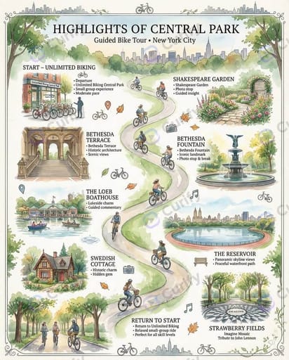
Tourist Spot Watercolor Map Infographic
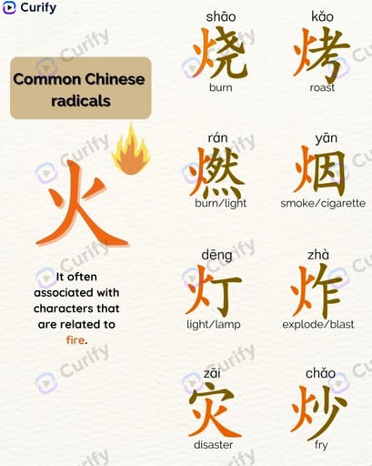
Chinese Radical Learning
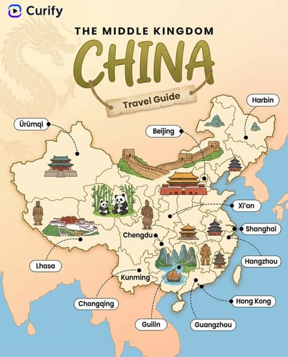
Travel Map

Multilingual Education Poster

English Learning Expression Cards
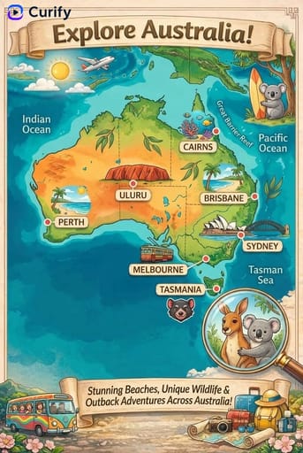
World Travel Map Illustration
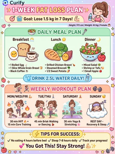
Weight Loss & Fitness Plan Cards
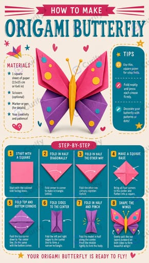
Kids Origami Step Tutorial Infographic Poster

Lifestyle Watercolor Infographic
Home & Lifestyle Guides

Health Tips Six-Method Cartoon Poster
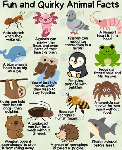
Kid-Friendly Grid Fun-Fact Infographic
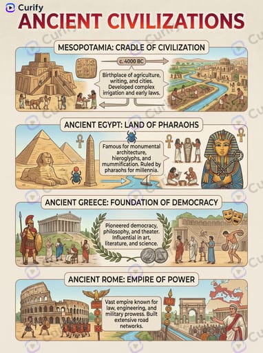
Educational Topic Infographic
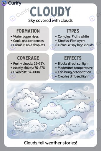
Kids Weather Infographic
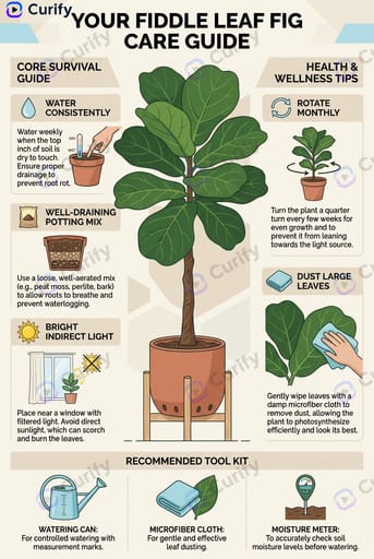
Houseplant Care Guides
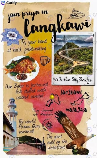
Travel Scrapbook Posters
About this template
What is this template?
This template generates a whimsical watercolor illustrated map of a chosen continent. The continent's outline is filled with soft watercolor washes per country, each labeled with the country name. Iconic landmarks, native animals, and cultural symbols are scattered across each region, with ocean illustrations of sea creatures, ships, and waves plus a compass rose.
Who should use it?
Suitable for elementary and middle-school geography teachers, kids' room decor brands, homeschooling parents, travel-themed nursery design, and educational publishers.
How to use it
- Pick a continent (Africa, Europe, Asia, South America, Oceania, North America).
- Generate a 4K whimsical watercolor continent map.
Example prompts
- Generate a watercolor map of Africa with native animals and landmarks.
- Create a Europe illustrated map for children with cultural symbols.
- Generate a watercolor South America map with sea creatures and a compass.