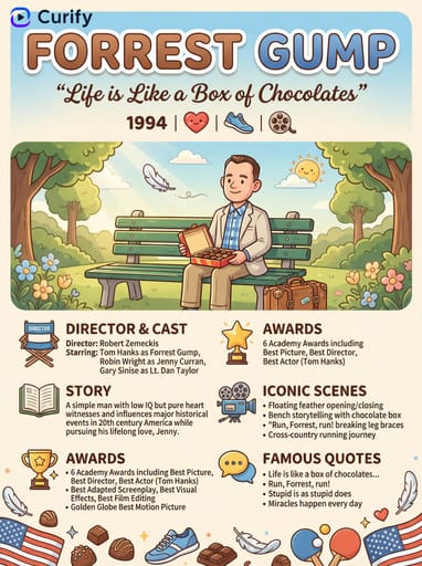
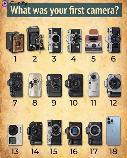
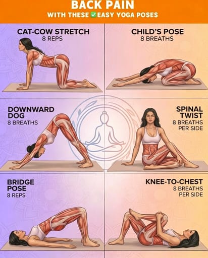
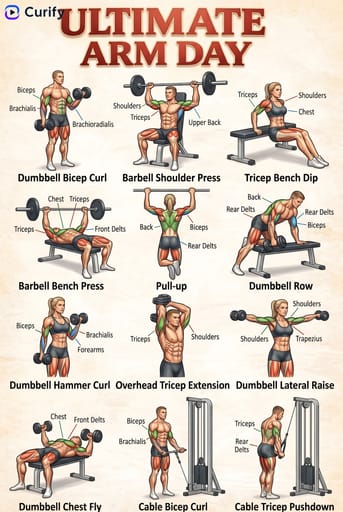
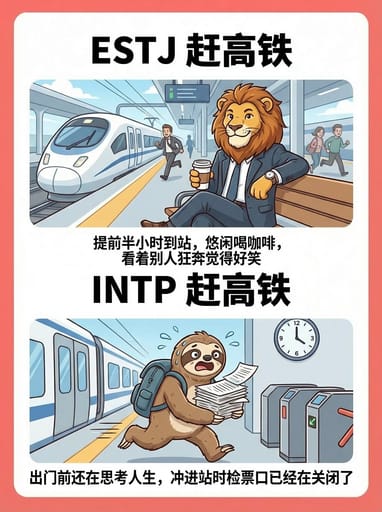
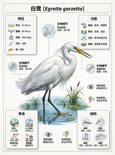
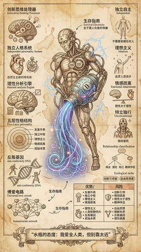
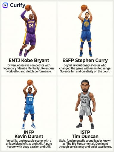
Example Images
このテンプレートを再現する
入力を使用してください — プロンプトのプレビューが即座に更新されます。
City Name
📝Please fill in City Name before generating.
プロンプトプレビュー
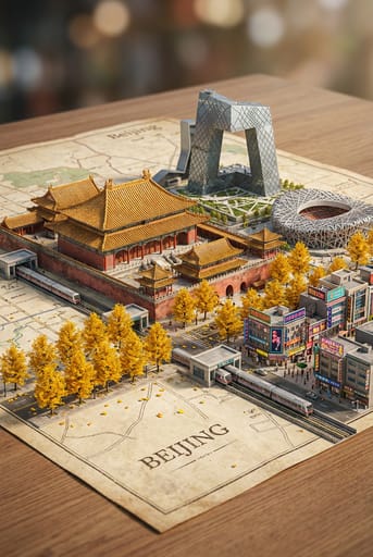
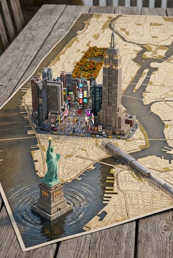
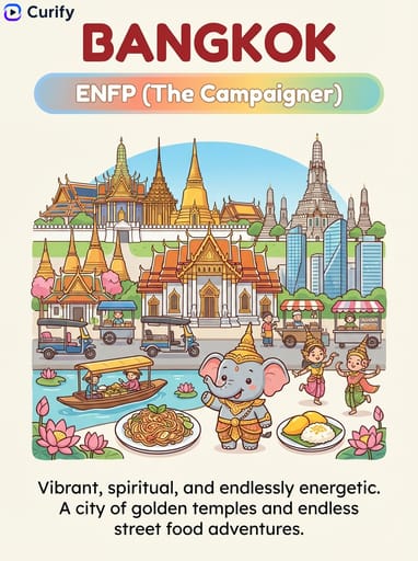
(Concept Artist) You are a top-notch city miniature landscape concept designer, skilled in combining city maps with three-dimensional miniature landscapes. The user has specified [{City Name}].

First, reason about {City Name} and determine: a fitting vintage map style for this city (e.g., vintage parchment map, old newspaper texture, aged canvas), the most iconic seasonal trees associated with this city, and the city's most characteristic transit system.

Then generate a hyper-realistic three-dimensional city miniature landscape on the determined vintage-style map: featuring local iconic landmarks with intricate architectural details, classic cultural scenery, bustling commercial streets with neon or traditional charm, lush seasonal trees adorned with colorful fallen leaves, and delicate city transit trains running along miniature tracks. All elements naturally emerge from the map like a vibrant 3D city model, with soft shadows enhancing the sense of depth between layers. Use soft studio lighting, harmoniously balanced warm and cool tones, cinematic depth of field effects, softly blurred background bokeh, and exquisite details in the textures of buildings and plants, in a 2:3 composition, hyper-realistic rendering, and high-definition quality. Directly output the image, with the city being {City Name}.他のナノテンプレート
他のカテゴリやプリセットを探索してください。


About this template
What is this template?
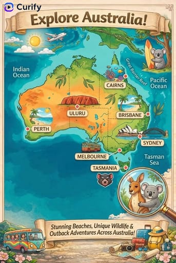
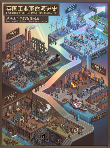
このテンプレートは「都市ミニチュア景観地図」を生成するためのものです。画面は地図の表面から立体的に浮き上がった超写実的な都市モデルのようで、ランドマーク、道路ネットワーク、公園、水系、居住区、交通施設を融合させ、都市空間情報を没入感のある方法で可視化し、地図感とモデル感を兼ね備えています。
Who should use it?
観光コンテンツ、都市宣伝、都市計画展示、地理教育、地方文化観光アカウント、そして「特定の都市を一目で認識できる」ビジュアルコンテンツを作成する必要があるデザイナーやクリエイターに適しています。
How to use it
- まず都市の名前を入力し、保持または強化したいランドマークや特徴的なエリアを指定します。
- 次に都市の空間的特徴を説明します。例えば、川が街を貫通、沿岸、山の街、高層ビルの密集、欧風の街区、旧市街と新市街の対比など。
- 出現させる必要がある要素を補足します。例えば、道路、橋、車の流れ、地下鉄、高架、公園、海岸線、森林など、地図の層を強化します。
- 最後に画風を説明します。例えば、超写実的なミニチュアモデル、等距離地図、観光ポスター感、または高精度の都市模型;もし都市の識別度が不足している場合は、「ランドマークと全体の街区レイアウトの特徴を強化する」ことを要求できます。
Example prompts
- 上海の都市ミニチュア景観地図を生成:東方明珠、陸家嘴の高層ビル群、黄浦江と橋がはっきりと見え、超写実的なミニチュアモデルが地図の表面から浮かび上がり、詳細が豊か。
- 重慶の山の街のミニチュア地図を作成:起伏のある道路、立体的な交通、山の街の建物が密集して分布し、橋、軽軌、江水を含み、視覚的な層が強い。
- パリの都市ミニチュア景観を生成:エッフェル塔、セーヌ川、街区の道路と公園が地図の表面に浮かび上がり、地図感とモデル感を兼ね備え、観光宣伝に適しています。