Join Curify to Globalize Your Videos
By using Curify, you agree to our
Terms of Service and Privacy Policy
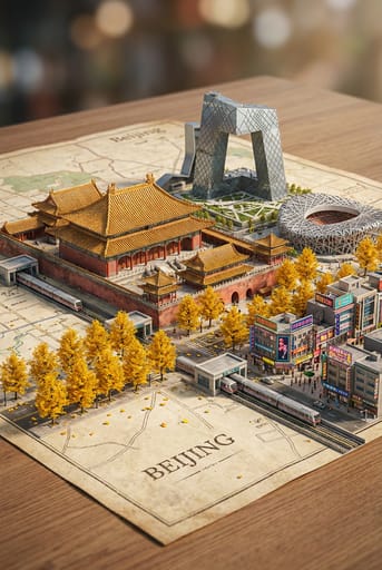
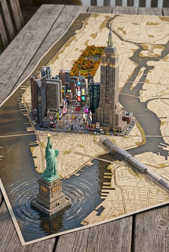
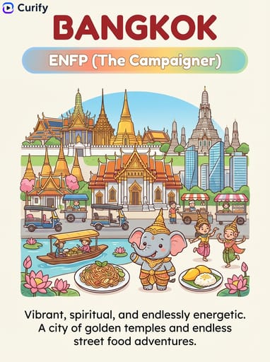
Nano Banana Prompt: City Miniature Landscape Map Generator
Generate a high-detail street-style map of a city with a hyper-photorealistic miniature version dynamically emerging from its surface, including landmarks, scenery, streets, trees and transit.
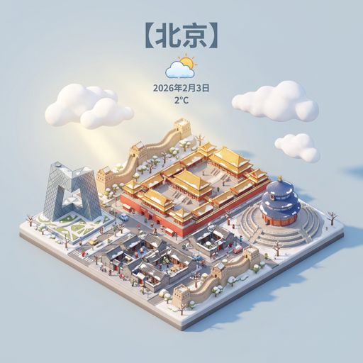
Example Images
Reproduce this template
Use your inputs — the prompt preview updates instantly.
(Concept Artist) You are a top-notch city miniature landscape concept designer, skilled in combining city maps with three-dimensional miniature landscapes. The user has specified [{City Name}].

First, reason about {City Name} and determine: a fitting vintage map style for this city (e.g., vintage parchment map, old newspaper texture, aged canvas), the most iconic seasonal trees associated with this city, and the city's most characteristic transit system.

Then generate a hyper-realistic three-dimensional city miniature landscape on the determined vintage-style map: featuring local iconic landmarks with intricate architectural details, classic cultural scenery, bustling commercial streets with neon or traditional charm, lush seasonal trees adorned with colorful fallen leaves, and delicate city transit trains running along miniature tracks. All elements naturally emerge from the map like a vibrant 3D city model, with soft shadows enhancing the sense of depth between layers. Use soft studio lighting, harmoniously balanced warm and cool tones, cinematic depth of field effects, softly blurred background bokeh, and exquisite details in the textures of buildings and plants, in a 2:3 composition, hyper-realistic rendering, and high-definition quality. Directly output the image, with the city being {City Name}.Other nano banana templates
Explore other categories and presets.


About this template
What is this template?
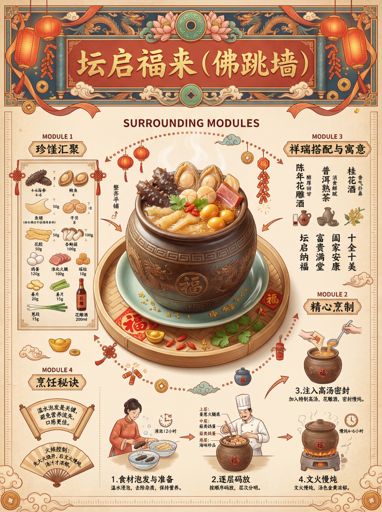
This template is used to generate 'city miniature landscape maps'. The scene resembles a hyper-realistic city model that rises from the surface of a map, integrating landmark buildings, road networks, parks, water systems, residential areas, and transportation facilities, visualizing urban spatial information in an immersive way, combining map and model aesthetics.
Who should use it?
Suitable for travel content, urban promotion, city planning displays, geography education, local cultural tourism accounts, and designers and creators needing to create 'visual content that instantly identifies a city'.
How to use it
- First, input the city name and specify the landmarks and characteristic areas you wish to retain or enhance.
- Then describe the spatial characteristics of the city, such as rivers running through the city, coastal areas, mountain cities, dense skyscrapers, European-style blocks, comparisons between old and new towns, etc.
- Supplement the elements that need to appear, such as roads, bridges, traffic, subways, elevated roads, parks, coastlines, forests, etc., to enhance the map's layers.
- Finally, specify the art style, such as hyper-realistic miniature models, isometric maps, travel poster feel, or high-precision city sand table; if the city's recognizability is not enough, you can request 'enhance the characteristics of landmarks and overall block layout'.
Example prompts
- Generate a Shanghai city miniature landscape map: Oriental Pearl Tower, Lujiazui skyscraper group, Huangpu River and bridges clearly visible, hyper-realistic miniature model rising from the map surface, rich in detail.
- Create a Chongqing mountain city miniature map: undulating roads, three-dimensional traffic, mountain city buildings densely distributed, including bridges, light rail, and river water, strong visual layers.
- Generate a Paris city miniature landscape: Eiffel Tower, Seine River, street roads, and parks emerging from the map surface, combining map feel and model feel, suitable for tourism promotion.