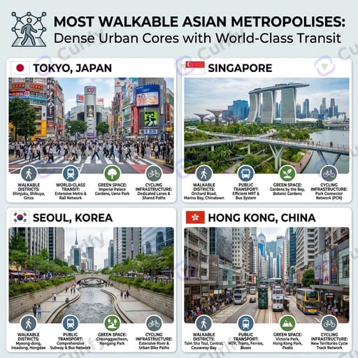
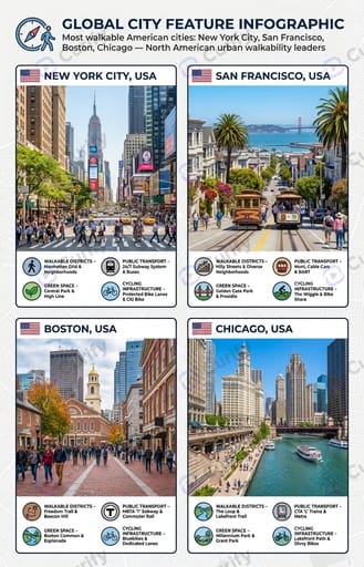
(Global City Feature Infographic Creator) Grid layout urban feature infographic poster themed 'Most walkable American cities: New York City, San Francisco, Boston, Chicago — North American urban walkability leaders'. Layout: Multiple equal rectangular city card panels arranged in neat grid, every single city panel: top left small national flag + bold city&country title, middle large realistic panoramic landmark cityscape photo of local iconic architecture and pedestrian street scene, bottom row of circular icon + short descriptive text labels highlighting city core features like walkable districts, public transport, green space, cycling infrastructure; Optional top global headline banner with intro icon and theme subtitle for full infographic. Style: Clean modern infographic design, subtle dark or bright customizable background, crisp border segmentation for each city tile, high detail photorealistic city scenery, clear sans-serif typography, vibrant natural city color grading, 8K high definition print quality, flexible grid auto-adapts based on input city quantity. Subject: Walkable city feature showcase infographic for Most walkable American cities: New York City, San Francisco, Boston, Chicago — North American urban walkability leaders.